Lewiston, Idaho, to Winchester
We climbed away from the Snake River valley and ended up on unpleasant Route 95, with fast trucks and a poor shoulder. I’m pretty good at mentally checking out under those conditions and letting songs repeat in my head. My steel drum band was playing that day at the Bowdoin Reunion, and I was sad to miss that, but second best was a couple of hours of Pan Fried Steel’s repertoire on mental repeat: “Jumpin the Line,” snatches of “Bahia Girl”, and then “Little Margaret” in honor of Gregg Allman.
Then Adventure Cyling did its magic. Just when you start suspecting their maps are just taking the obvious route, they throw in something spectacular. Here’s the route up the Old Winchester Grade Road. Those wiggly lines say you’re going to climb:
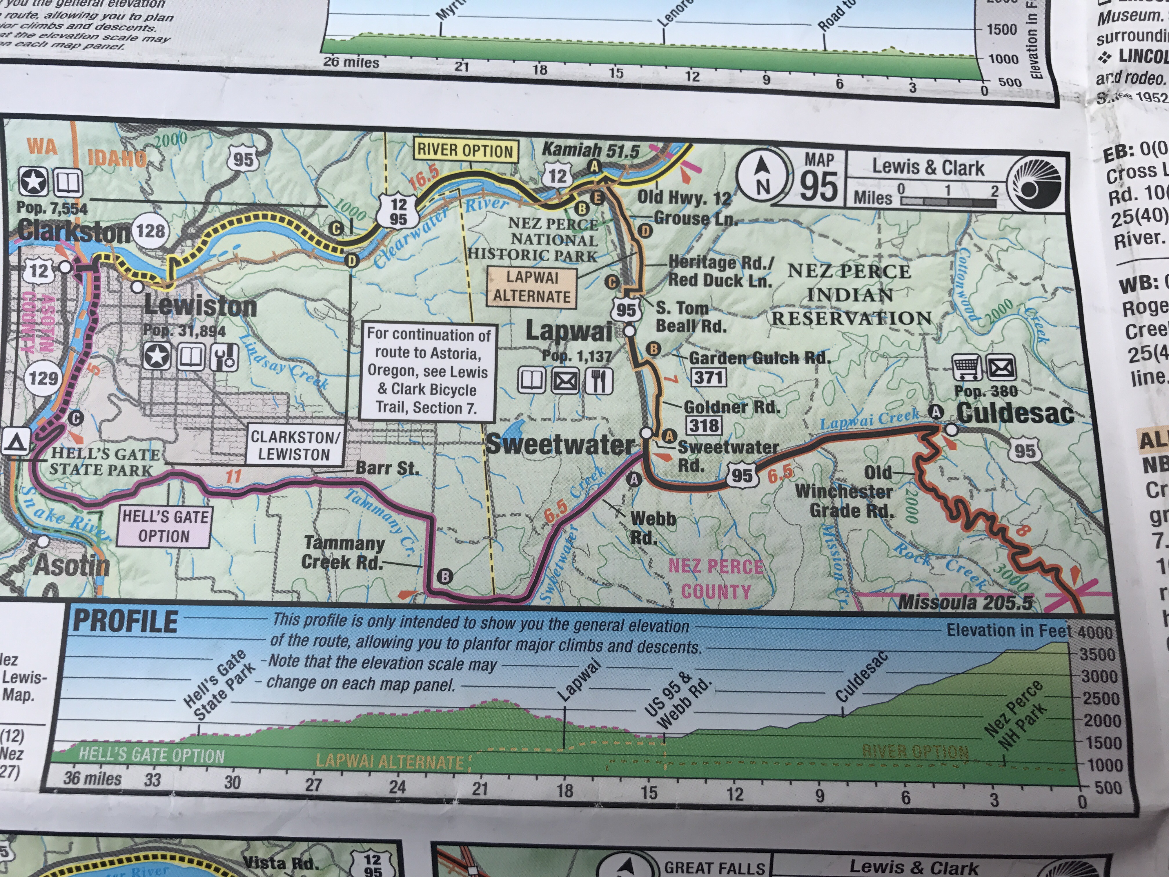
The road rises in gentle curves from 2000 feet to 4100 feet in eight miles. With no traffic, smooth surface, sunshine, a gentle breeze, and Red Tail Hawks and even a single engine plane flying below us, we were content. The one surprise was this mattress on the wayside. The Maine legislature just passed a “mattress stewardship” law, our dear governor vetoed it, and the legislature didn’t override. The right to throw a queen size mattress into a perfect landscape lives on.

We arrived in high-up Winchester, whose Main Street is appropriately marked with a suspended rifle.

I was sad to notice that Meri, my handlebar mascot, has absconded. I knew she would at some point; I hope she departed for the big views on the Winchester Grade Road.
The state park campground was delightful, on a fishing lake stocked with fat rainbow trout that people were determinedly reeling in off the dock. Near us was a Mennonite group laughing it up. Next came a young man chain smoking, playing sad country music out of his truck, and staring into his fire pit. He had me a little worried, here in Winchester town. But right next door was a charming family taking their tow headed little kids and enormous yellow lab camping for the first time. They invited me for a glass of wine after Mark and the kids had gone to bed. I found out why the dad became a cop after finishing military service. “I wanted a job where I could have a gun. I just feel better with a gun.” They had nuanced opinions, except for their impatience with North Korea: “We should just nuke them out of existence.”
Winchester to Kamiah
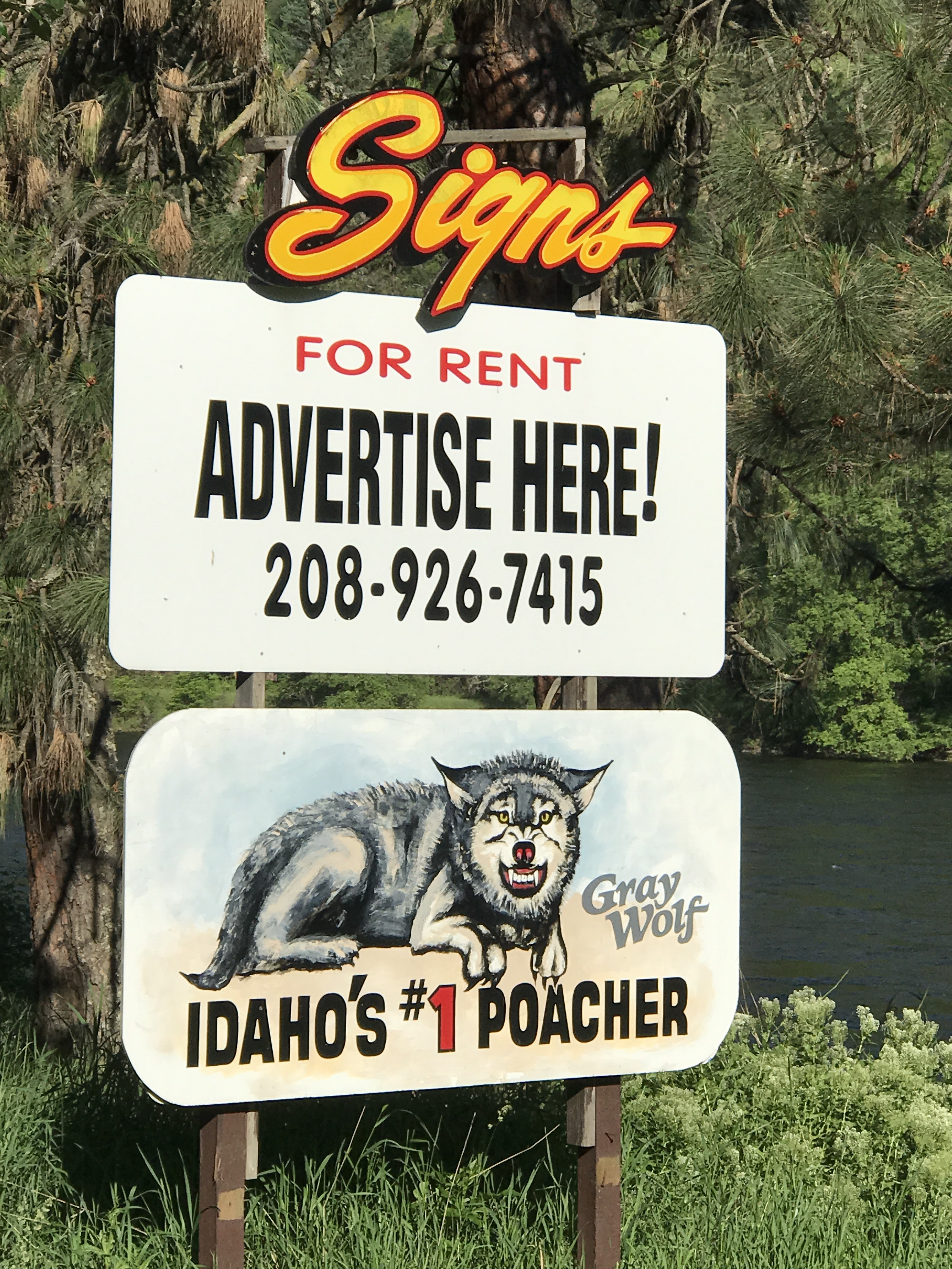
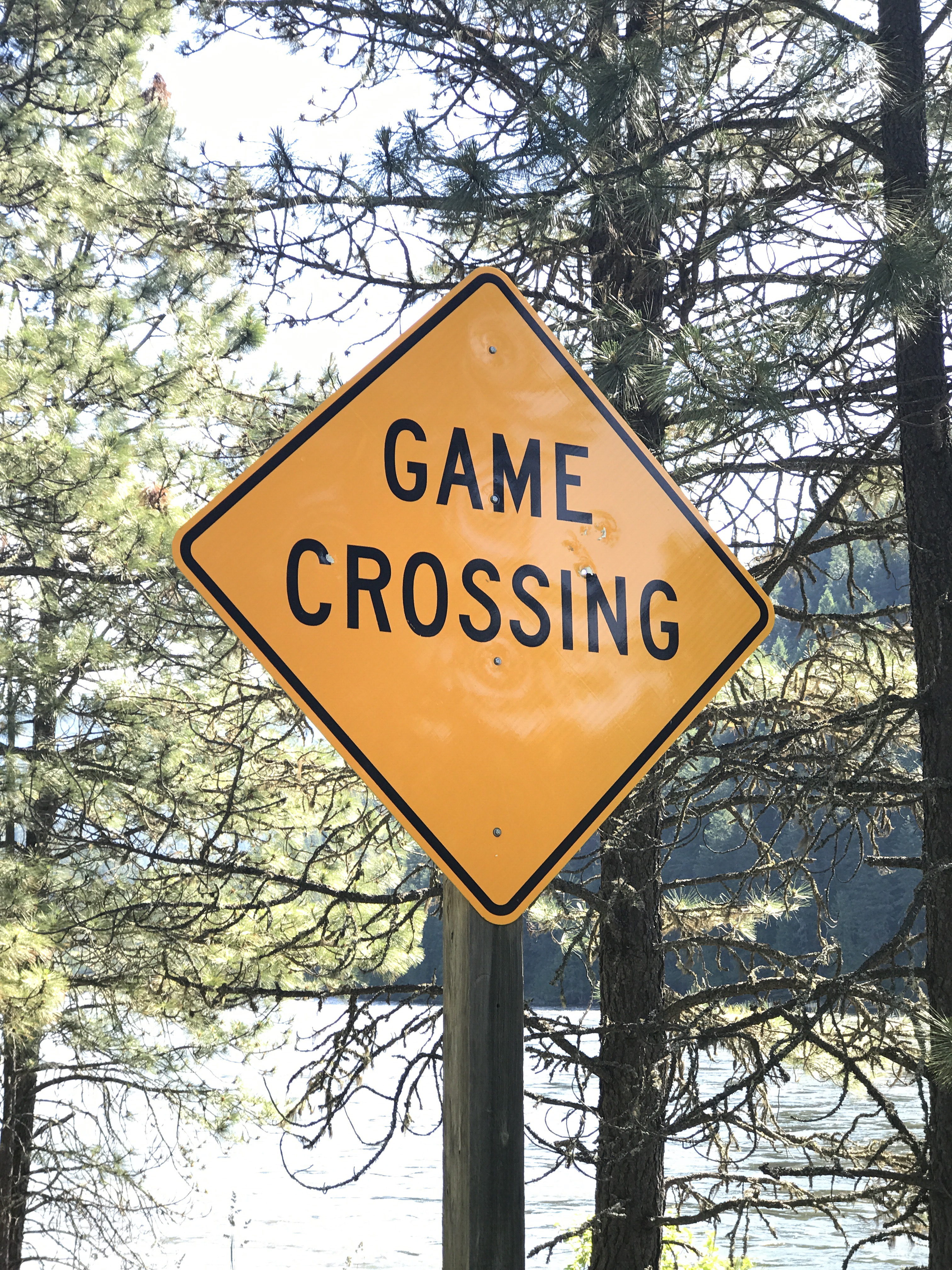
The next day’s ride took us through farmland on the high plateau. We were back on Route 95 again, unpleasant except that we had a vistas of the range from Glacier Park to the Seven Devils Mountains. Again, thanks, Adventure Cycling, for eventually turning us off that road and onto an utterly delightful empty road up through cultivated fields on the high plain. We rolled up and down until it was time to descend to Kamiah in a 15 minute long downhill down a butte to the North Fork of the Clearwater River, on the Nez Perce reservation. The temperature went from 75 to 95. The town is the site of Lewis and Clark’s Long Camp, where they waited around for the snow in Lolo Pass to melt. It’s certainly a beautiful valley. I think there’s lots of wildlife, though where in Maine you might see a “wildlife crossing” sign, in Idaho you see this:

Reading the regional paper I saw a letter to the editor about roadkill. Good, I thought, someone cares about the carnage that roads inflict upon wildlife. However, the letter bemoaned not that vehicles slaughter animals but that the road department doesn’t remove the carcasses, and schoolchildren have to see them.
I’m afraid this is a common point of view in Idaho:
Kamiah to Lolo Pass
For the next two days we rode 100 miles up along the Clearwater and the Lochsa Rivers at very high water. The experience of traveling along free flowing rivers is unforgettable. I kept thinking the rushing water would turn off in the afternoon the way it does on every other rafting river I’ve experienced. In 1965 there were plans to dam the canyon at Kooskia, but in 1968, just in time, Congress enacted the Wild and Scenic Rivers Act. (It’s impossible to imagine such leadership today.) Both the Middle Fork of the Clearwater and the Lochsa Rivers are permanently protected and free running. The Selway-Bitterroot Wilderness Area surrounds the rivers, and all you see are trees, rocks, and water. Here Lewis and Clark took the Indian’s Lolo Trail up and down the “terrible mountains” as they called them, and as many historic plaques announced. However, we get to ride up a smooth road on our bikes, with campgrounds at convenient intervals.
When we started at Kamiah the river boiled in Class 1 riffles. The rapids increased to Class 2, and we enjoyed choosing the line we’d take by canoe. Then came Class 3, and I could still imagine a line but knew how my stomach would feel. Then the steepness turned the rapids to Class 4, and I started thinking how Noah and Hania would enjoy kayaking this. The rapids continued all day and most of the next, right up to Lolo Pass. Kayaks, rafts, and catboats went by.
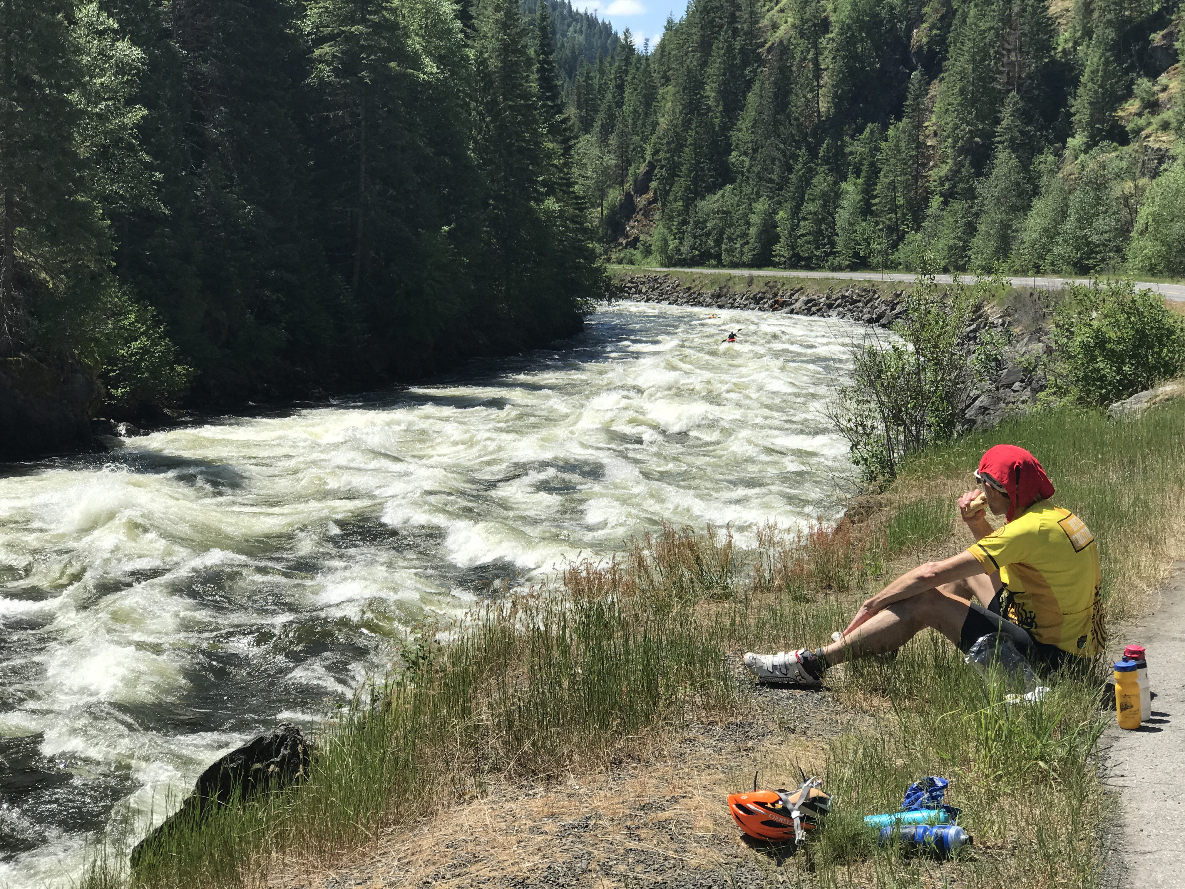
We stopped at Lochsa Falls and guitily enjoyed watching two catboats and a raft turning over in the rapids. A kayaker told us the water temperature is 48 degrees.

At our campground, we had a good talk with Leroy and Sylvia from Lewiston, Idaho. They were a retired couple happy to share their views on immigration, “kids these days,” and Trump. Some of our opinions overlapped, which was interesting to discover. Sylvia had her own answer for where we are going, though. “God will take us to a better world, so I’m not worrying.”
There’s nothing like sleeping 10 hours: a rainy night made us retreat to the tent early.

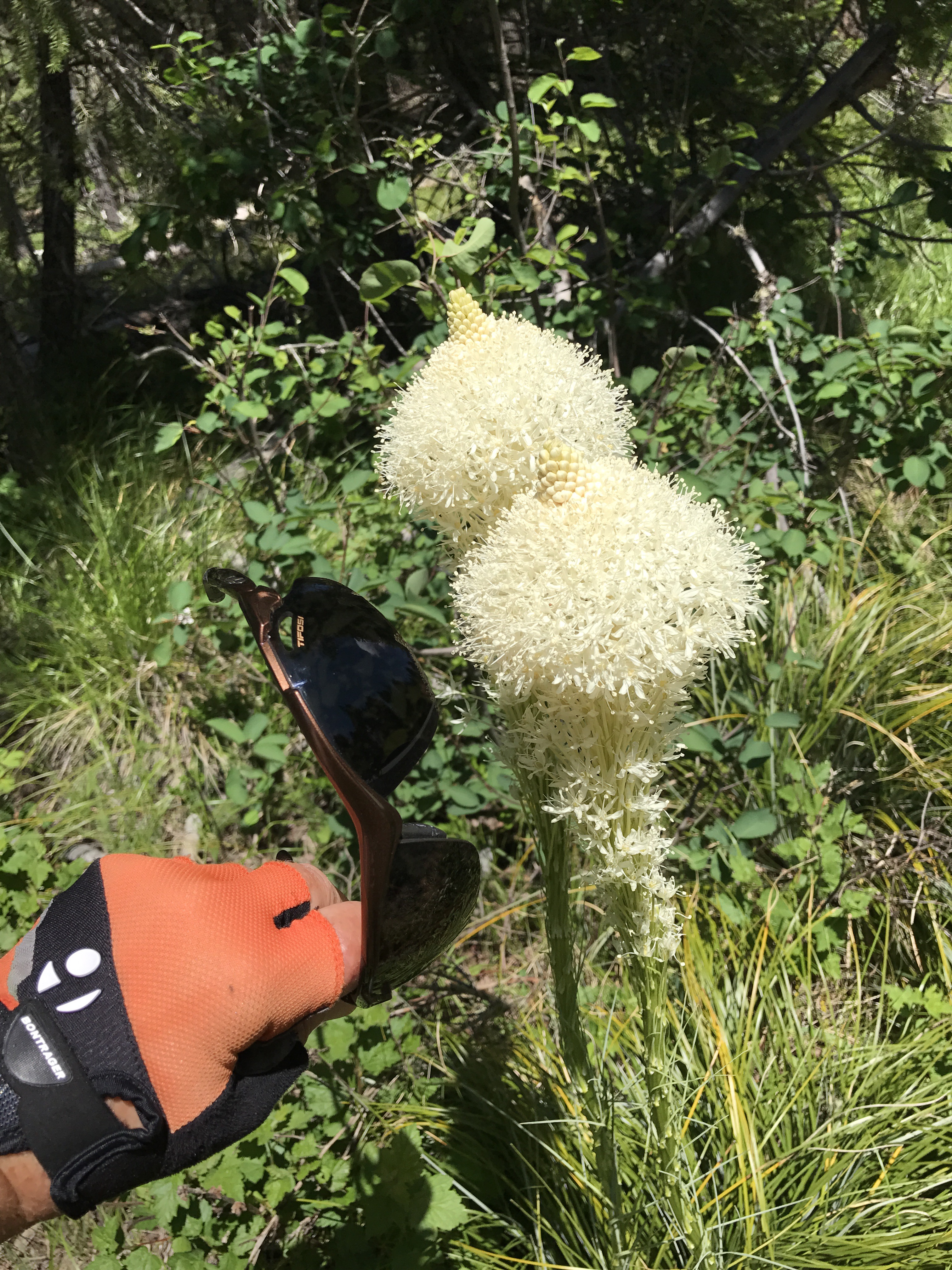
The next day was nice weather again. Mark was tolerant as usual of all my stops for picture taking, including of this plant I’ve never seen. It might be in Lewis’s nature journals.
The climb to Lolo Pass had loomed in our thoughts, but I’m concluding that we Easterners have a different standard. The road went up so gradually, and the final steep part was so short, that all the warning of folks along the way seemed grossly exaggerated. Only the last four miles were steep, and those weren’t even as steep as the top of Kancamagus Pass in New Hampshire. “Do you know you are riding the most dangerous road in America?” someone asked me. Hunh? Yes, there are some big trucks, but not that many. There are continual curves and not much of a shoulder, but the vehicles can see you, and the surface is pretty good. Once in a while there’s a dropoff to the river, and I hear many drunk motorcyclists have met their end. But this road is much better than most roads in Maine.
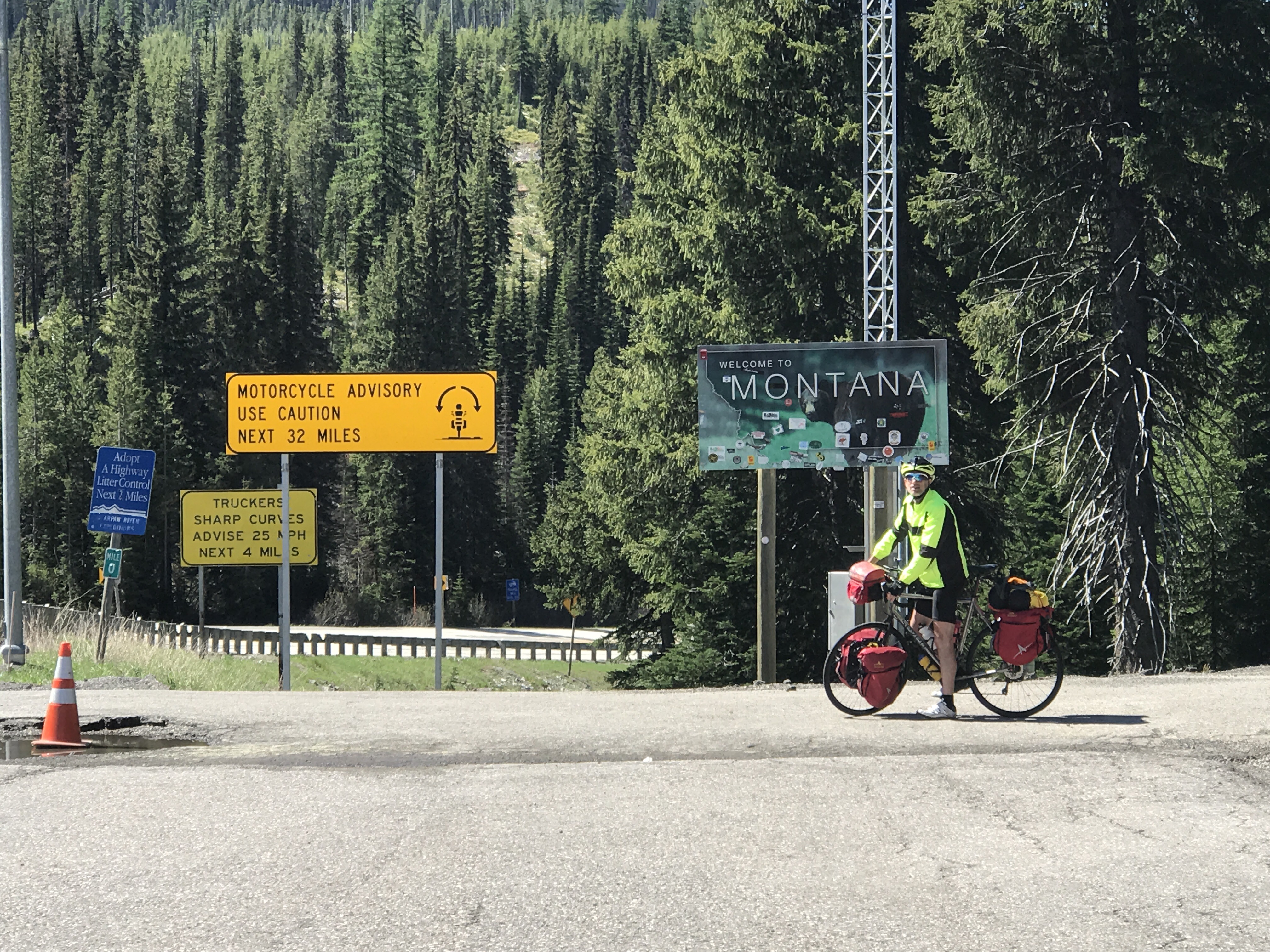
Lolo Pass! We tried to ride higher but there was snow.
And on down into Montana.

Stellar commentary once again. Thank you.
LikeLike
Thanks, David! It’s fun that you are reading it.
LikeLike
Rivers had to be tempting as you were climbing steadily! Beautiful images and writing Karen.
LikeLike
Thanks, Peggy. I’ll add that a kayaker told us the water is 48 degrees.
LikeLike
Don’t know how you have the time or energy for all of this, providing a history lesson as well. I am enjoying it all.
LikeLike
Thanks, Polly. There are a lot of historical plaques, and Google gives good answers for the gaps. It’s fun.
LikeLike
Love this! Great commentary on a gusty ride through incredible country. Next entry we want a bit on lifestyle: meals, laundry, conversation. This will help us more fully integrate into your travels. Thank you for taking the time to post. We look forward to each installment.! Safe travels!
LikeLike
OK! But then Anna will know how soft we are. Just today Mark wanted to spend his free time finding a laundromat, whereas I went to a coffee shop and wrote a blog. Great division of labor.
LikeLike
So the wildest wild-west terrain
has nothing on the State o’ Maine.
(this is why we send scouts!)
LikeLike
Mark and I just figured out that L and C shouda gone down the Clark Fork to the Columbia. Jeez. Would have saved a lot of plaques.
LikeLike
Karen this is so engaging. It’s great to read the political discussion notes too. So you do not sound like you are getting bored! What is Mark doing to entertain himself??
LikeLike
He’s happy just cranking!
LikeLike
What a grand adventure. I love the photos.
LikeLike